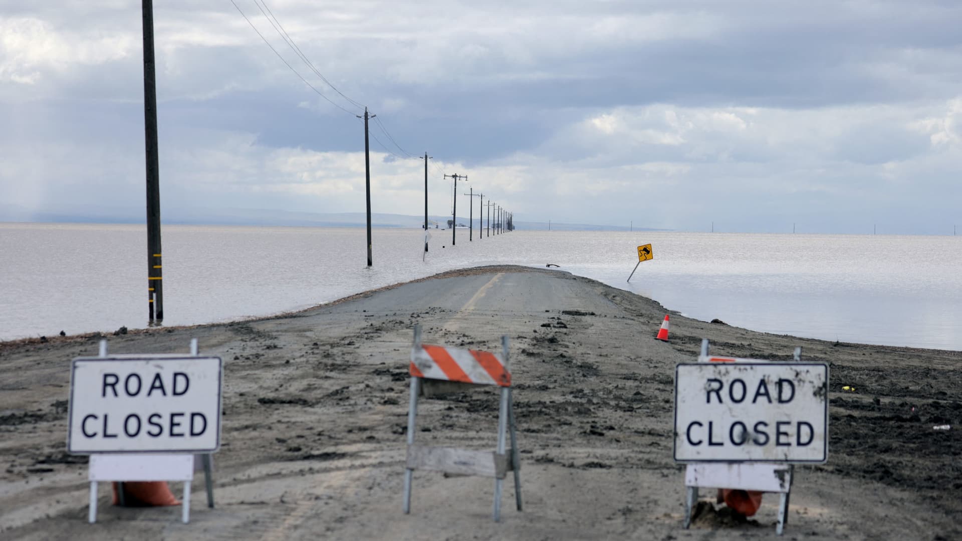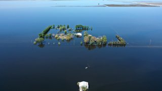
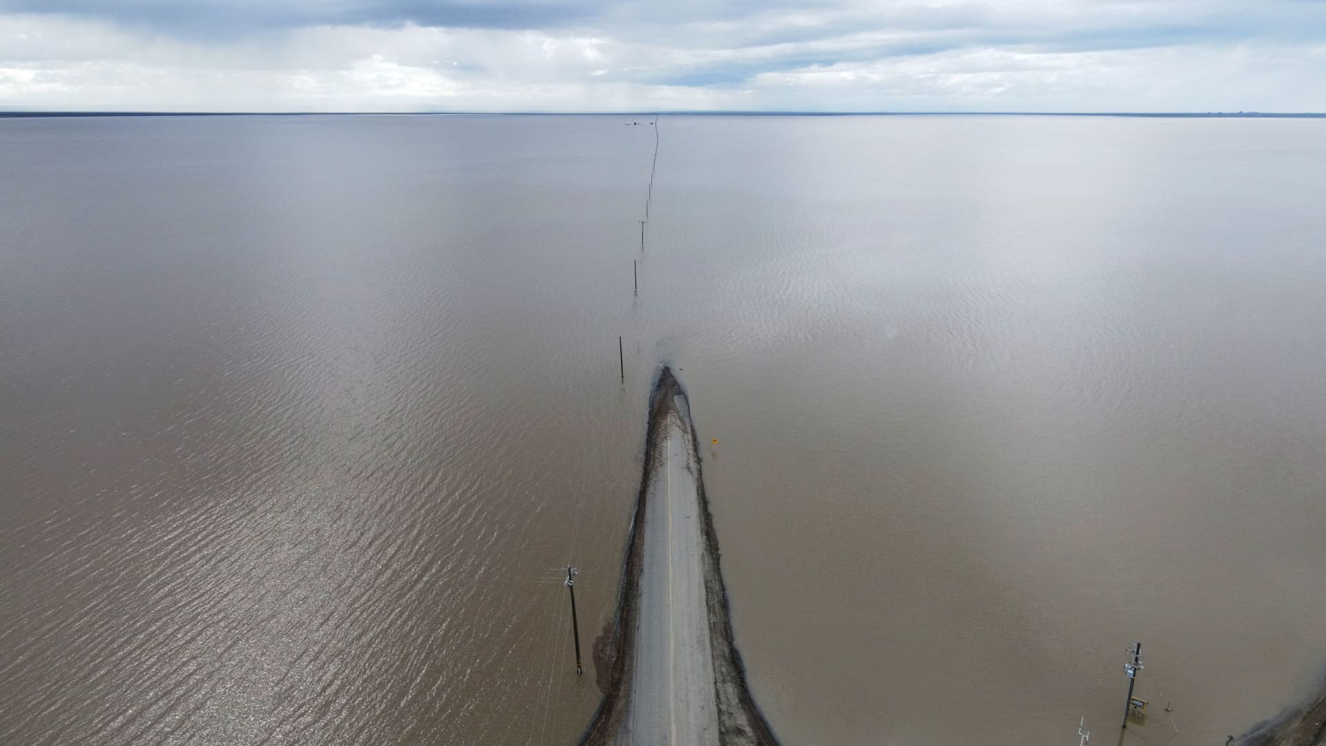
- Satellite images taken over the past several weeks show a staggering resurrection of Tulare Lake in California’s Central Valley after a year of near-record rainfall.
- The lake, which was drained decades ago for cropland, runs about ten miles from bank to bank on land used to grow almonds, tomatoes, cotton and other crops.
- Tulare Lake could remain for as long as two years and trigger billions of dollars in economic losses and displace thousands of farmers.
Satellite images taken over the past several weeks show a dramatic resurrection of Tulare Lake in California's Central Valley and the flooding that could remain for as long as two years across previously arid farmland.
The satellite imagery, provided by the Earth imaging company Planet Labs, show the transition from a dry basin to a wide and deep lake running about ten miles from bank to bank on land used to grow almonds, tomatoes, cotton and other crops.
Scientists warn the flooding will worsen as historically huge snowpack from the Sierra Nevada melts and sends more water into the basin. This week, a heat wave could prompt widespread snow melt in the mountains and threaten the small farming communities already dealing with the resurrected Tulare Lake.
The water in the lake bed could trigger billions of dollars in economic losses and displace thousands of farmers and residents in agricultural communities. Continued flooding also threatens levees, dams and other ailing flood infrastructure in the area.
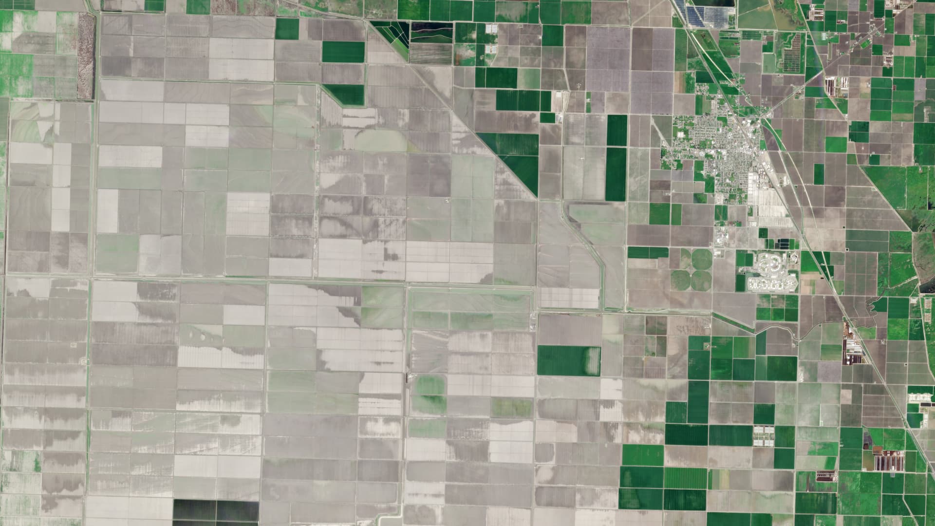
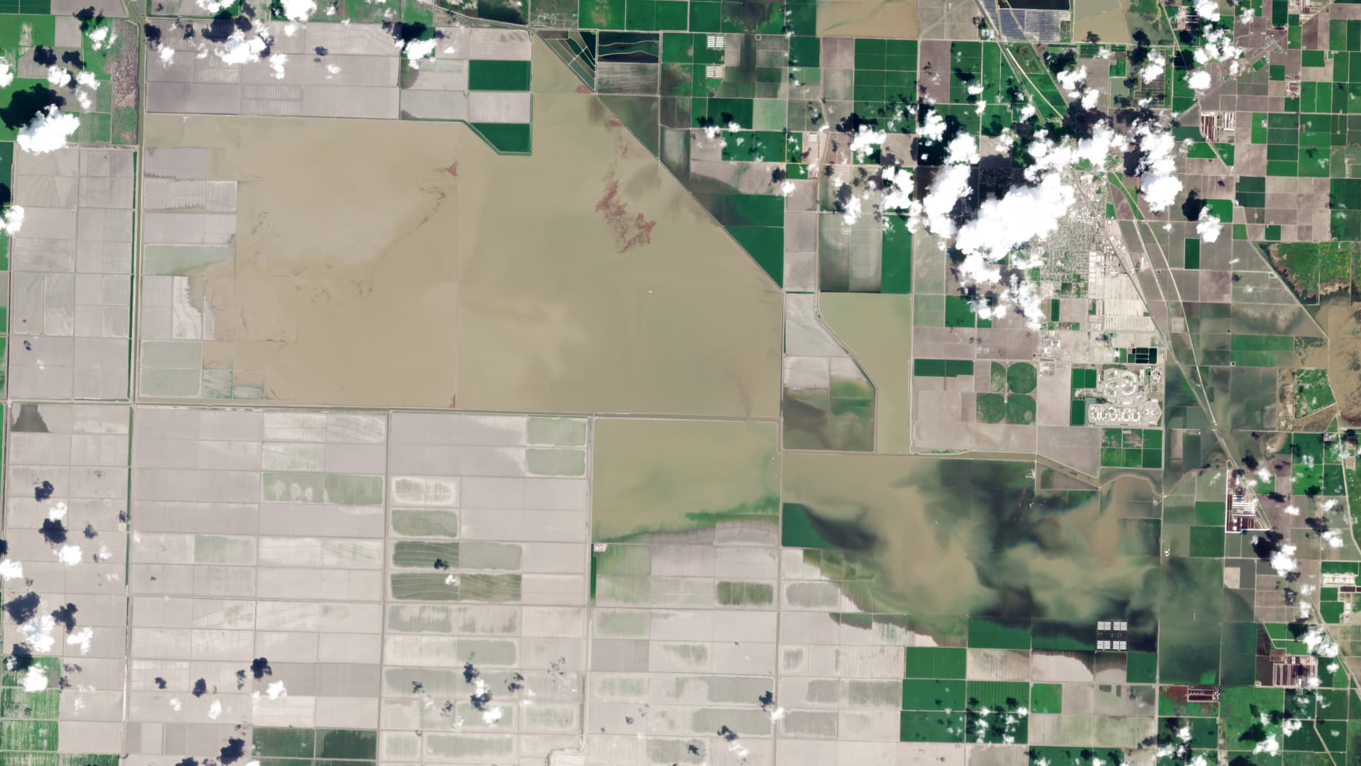
Tulare Lake was the largest body of freshwater west of the Mississippi River up until the late 1800s, when its tributary rivers were diverted for agricultural irrigation and municipal water uses. As the reformed lake continues to grow larger, farmers worry they will lose entire harvests and their homes will be inundated.
Money Report
The town of Corcoran in the Central Valley, for instance, has a dirt levee at risk of breaching from rising waters and has requested emergency federal funding to raise the levee by a few feet.
Get a weekly recap of the latest San Francisco Bay Area housing news. Sign up for NBC Bay Area’s Housing Deconstructed newsletter.
Gov. Gavin Newsom paid a visit to Corcoran this week to assess the flood damage, and said the worst is still to come as the flooded basin sees an additional half-inch or inch of additional water each day. More water could keep flowing for the next 16 weeks.
"We're working with our federal and local counterparts to provide on-the-ground assistance and the support locals need," Newsom said. "This weather whiplash is what the climate crisis looks like."
Karla Nemeth, director of the California Department of Water Resources, said the last time there was major flooding in the basin was the 1980s and it took about two years for the water to evaporate or get pumped out. She said the department is coming up with a plan to divert water before it ever arrives at the lake bed.
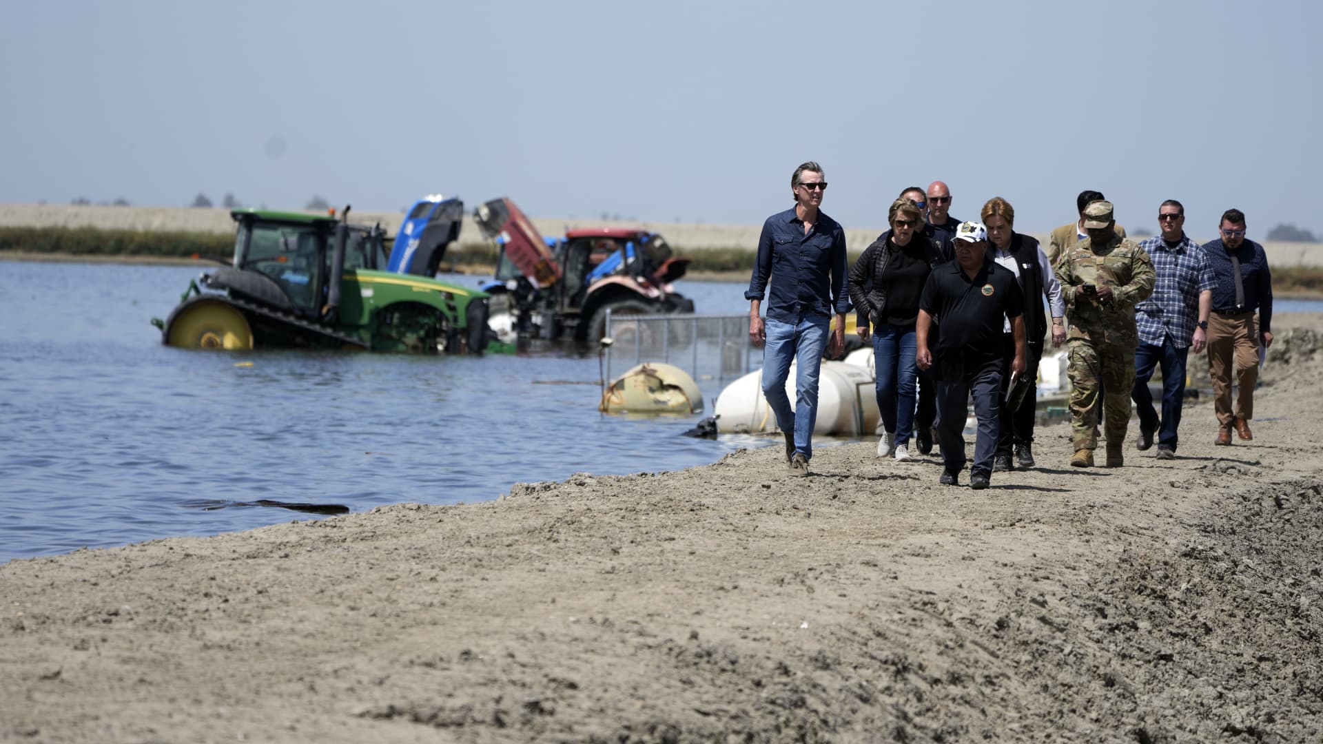
But more than 600 structures in Tulare County have already been damaged by flooding, according to county officials, and flood damage is still being calculated. Newsom's office has estimated $60 million in agricultural losses from the flooding of crop fields.
Potential solutions include installing equipment to pump water back into underground aquifers that are dried up from years of drought and overuse of the region's groundwater.
The state is providing shelter assistance for displaced residents and supplying flood prevention supplies including sandbags, muscle walls and rock and sand to shore up rivers and levees, according to the governor's office.
California is experiencing an unusually wet season following two decades of drought. A series of atmospheric rivers this year have led to near-record levels of snowpack and rainfall in many areas of the state.
A research team at Scripps Institution of Oceanography at UC San Diego found that climate change is intensifying atmospheric river storms and could increase resulting flood damage from $1 billion annually to more than $3 billion annually by end of the century.
Temperatures in the San Joaquin Valley are forecast to reach nearly 100 degrees by this weekend. And Yosemite National Park announced Tuesday that a good deal of the park would close on Friday as melting snowpack threatens floods.
