
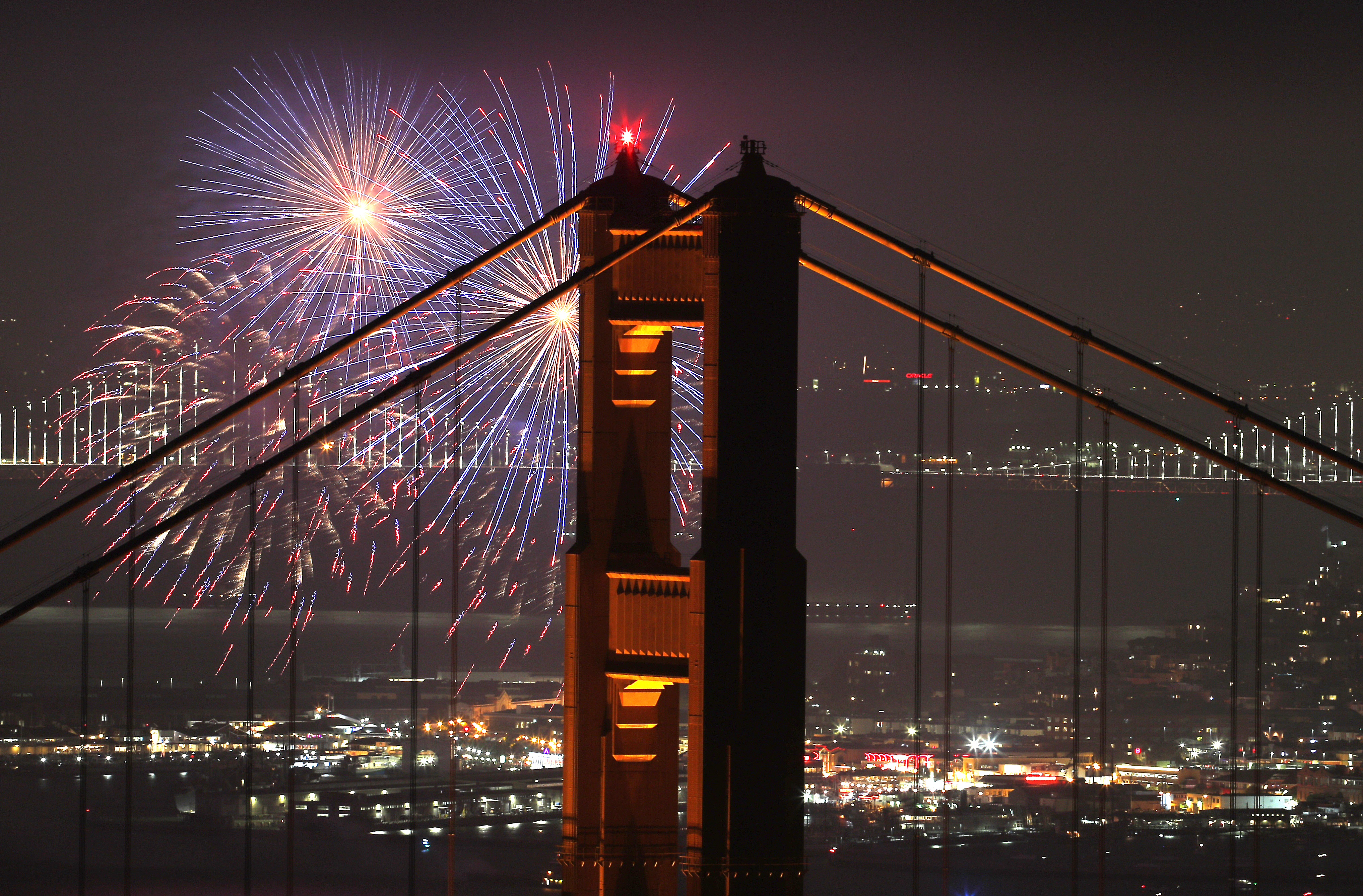
Weather conditions around the Bay Area appear promising for people who want to enjoy the Fourth of July holiday fireworks shows Tuesday evening, according to the National Weather Service.
The cooling temperatures, onshore breezes and hefty marine layer that started rolling into the region Sunday are expected to continue throughout the week.
Those conditions, however, are likely to be most pronounced during the morning hours Tuesday, clearing up during the day and then reappearing later in the evening, according to Meteorologist Brooke Bingaman.
"In San Francisco and even into Oakland, it's looking like we can start to get some clouds between 8 p.m. to 10 p.m. but the forecast right now is saying the thicker clouds are probably going to happen around 10 p.m. and after," Bingaman said.
In the North Bay, the forecast shows fairly clear skies around 9 p.m. or 9:30 p.m., when most fireworks are scheduled to pop off, she said.
Similarly, residents in the South Bay and East Bay valleys will have a decent chance of enjoying fireworks shows unimpeded by overcast skies.
"For right now there's promise, but we just have that caveat that Mother Nature still wants to do her own thing," Bingaman said. "It's not a slam dunk."

Temperatures in Oakland will top out in the low 70s and the daytime high in Downtown San Francisco is expected to be about 65 degrees.
Also, in San Francisco, wind gusts of between 15 mph to 20 mph are expected in the early afternoon, around the time the Giants will take the field against the Seattle Mariners.
Get a weekly recap of the latest San Francisco Bay Area housing news. Sign up for NBC Bay Area’s Housing Deconstructed newsletter.
After 5 p.m., the wind might pick up just slightly, maybe hitting 25 mph and then gradually dissipating later in the evening.
A similar wind pattern is expected in the East Bay.
In North Bay cities like Napa and Santa Rosa, the highs are expected to be between 78 to 80 degrees and in the inland East Bay regions around Concord and Livermore, temperatures will hit the mid to upper 80s.
San Jose's high will peak at about 84 degrees, Bingaman said.
Beachgoers should bundle up Tuesday, as coastal temperatures will hover from between the upper 50s to low 60s.
"If you're right along the coast, chances are you're going to see that cloud cover most of the day," she said.
As the week progresses, people should expect a persistent cooling trend, with temperatures dropping a little everyday until much of the Bay Area is experiencing temperatures that are anywhere between 5 degrees to 12 degrees below normal.
"The nice thing is we're going back into a cooling trend after the heat we had this weekend," Bingaman said.