
The Bay Area will mostly dry out for a few days starting Thursday before rain is expected to return Sunday along with another round of potential flooding, mudslides and wind damage.
As a powerful low-pressure system and surface-level cold front that brought wind and rain to the entire region continues to move east, residents are being advised to keep umbrellas handy.
The unsettled weather following in the storm's wake could produce scattered showers and thunderstorms into Thursday afternoon, according to the National Weather Service.
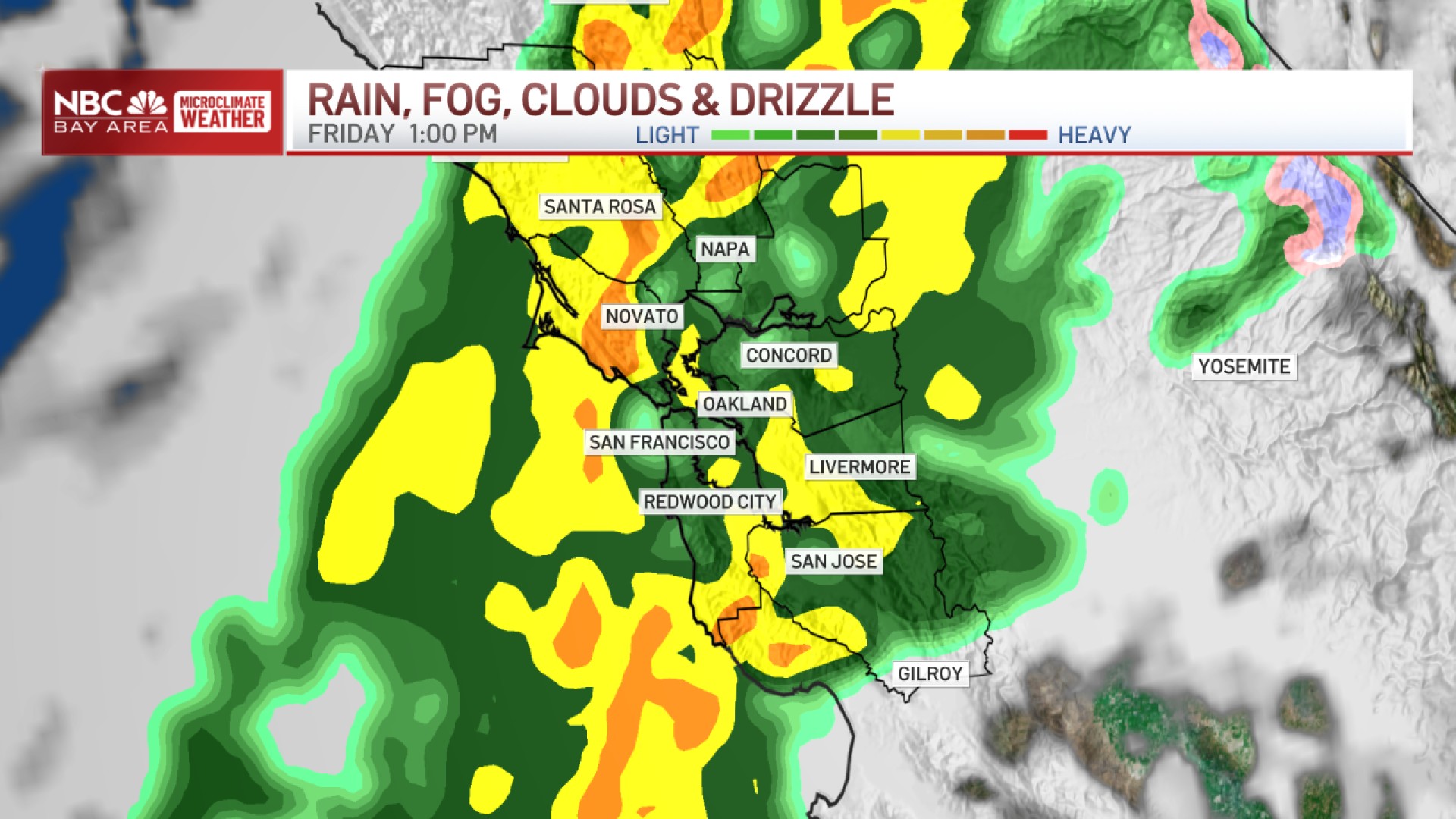
"Today there's still showers moving through. These will diminish and there will be light rain Friday and Saturday," said weather service meteorologist Nicole Sarment. "The next system moves in Sunday late morning to early afternoon, with wind as well."
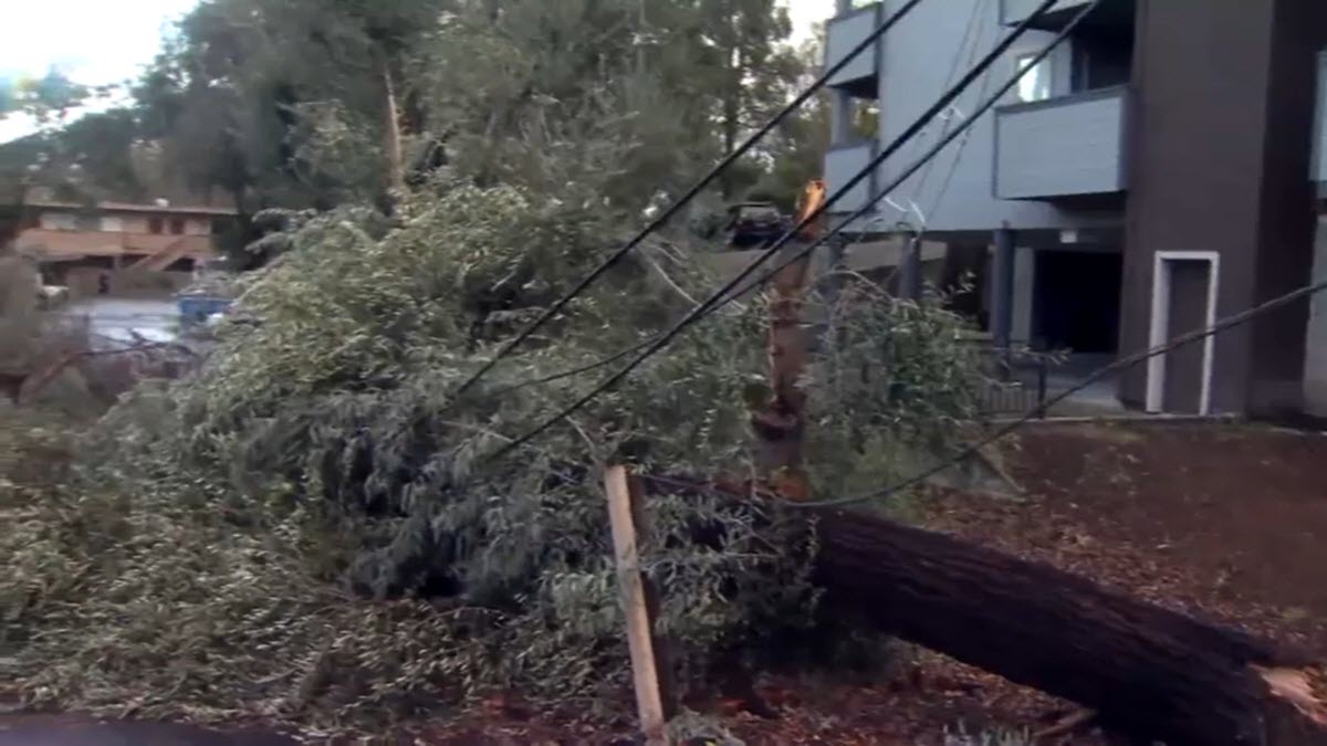
Sunday's storm, which will last well into Monday, could lead to worse flooding and wind damage as it rolls through an already saturated region, and people should be on the alert for flooded roadways, downed trees and power lines and possible mudslides.
"The potential for it is actually for it to be more impactful, also this one is going to be aimed a little bit more at the Central Coast than the North Bay," Sarment said.
The highest winds will be in the Santa Cruz and Santa Lucia mountains with gusts of up to 45 mph or greater, while rain totals of between 1 to 3 inches are likely across the Bay Area, with 4 to 7 inches possible in the coastal mountain ranges.
Get a weekly recap of the latest San Francisco Bay Area housing news. Sign up for NBC Bay Area’s Housing Deconstructed newsletter.